Engine on, sails up, the wind at the watch change, a spoken note. Sharmionics captures the essentials in a tap, so the rest of the day belongs to the water.
Sharmionics handles the paperwork, the checklists and the log quietly in the background, works with no signal, and stays out of the way until you need it.
Two buttons do most of the work: Engine on/off and Sails up/down. They are 56 points across, so you can hit them with a thumb while holding on with the other hand.
One tap records what it is blowing. That is all the app needs to count your hours above 5 Beaufort.
Press, say what happened, confirm. Timestamped and positioned from the moment you started talking, recognised on the phone with no signal.
“You have started moving, open a leg?” Start tracking once at the beginning of the charter; after that the app proposes and you confirm.
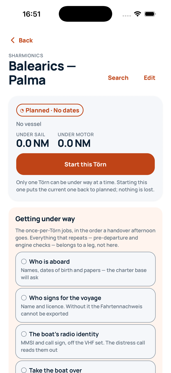
Each part of a charter week has its own jobs. The app brings up the right ones at the right time.
Photograph the charter booking and the app reads the boat, the base, check-in, and the deposit you will be asked for at the desk. Add your crew once from their passports, and they are there next season too.
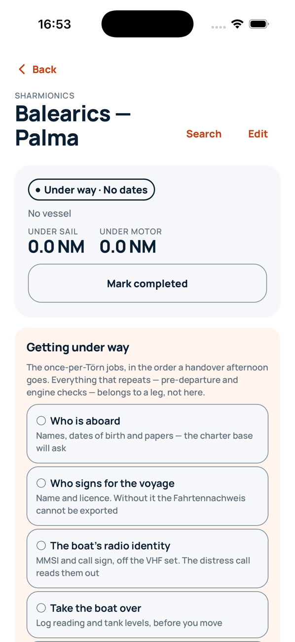
Getting under way walks you through the afternoon in order: crew, radio identity, log and tanks, provisioning, the safety briefing, and who does what in an emergency.
Engine, sails, wind, a spoken note. Charts with seamarks, a distress call already filled in, and your position clearly marked when the fix is getting old.
A short daily round: bilges, oil, coolant, lights, batteries, diesel and water. The app spots that you have stopped near a marina and asks; you tell it whether you are anchored or on a mooring.
A ship's log with the track plotted, a crew list, your papers in one charter pack, GPX and CSV, and the Fahrtennachweis if you need it.


Works with no signal at all.
MAYDAY, PAN PAN and MEDICO with the boat's name, call sign, MMSI read as digits, position, souls on board and hull colour.
Fire, flooding, abandoning ship: named duties against named people, on a page you can print and pin at the chart table.
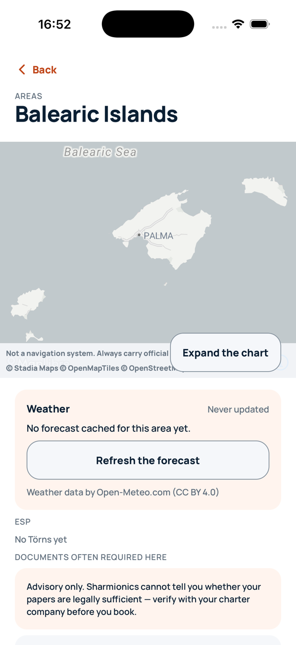
Vector charts with OpenSeaMap seamarks and optional depth shading. A built-in coastline when there is no signal. Carry official charts too.
MAYDAY MAYDAY MAYDAY · this is sailing yacht SEA SWALLOW · MMSI 2 6 9 1 2 3 4 5 6 · my position 39°33.4′N 002°37.8′E · 6 persons on board · white hull

| Etappe | Segel sm | Motor sm | > 5 Bft h |
|---|---|---|---|
| Palma → Andratx | 18.4 | 4.2 | 0 |
| Andratx → Sóller | 27.9 | 3.1 | 6 |
| Sóller → Pollença | 31.2 | 2.6 | 9 |
| Pollença → Ciutadella | 24.0 | 6.8 | 3 |
| Total | 101.5 | 16.7 | 18 |
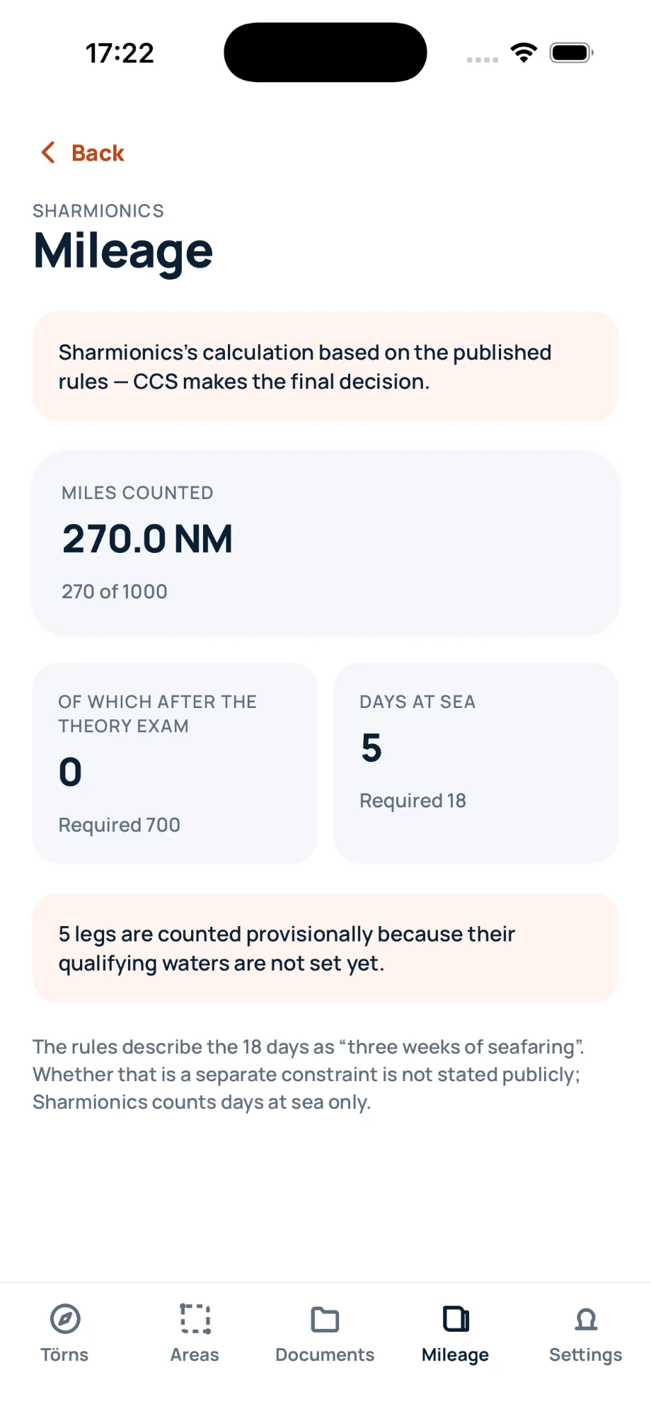
Because engine, sails and wind were recorded at the time, the app knows your miles under sail and under motor, and your hours above 5 Beaufort. The mileage screen shows where you stand against the qualification, and the Fahrtennachweis comes out in German, laid out for CCS in Bern.
If something was not recorded, the app says so rather than guessing. A logbook that guesses is worse than one with a gap in it.
Everything works on the device, offline, from the moment you install it.
A link sent to your email. There is no password.
Passports, licences and certificates are encrypted on the device and recognised there. Nothing goes to a cloud service to be read.